GeoPackage


Download tiles from WMS or XYZ servers, and import GEOINT from a variety of sources: KML, shapefile, geotiff, and more.
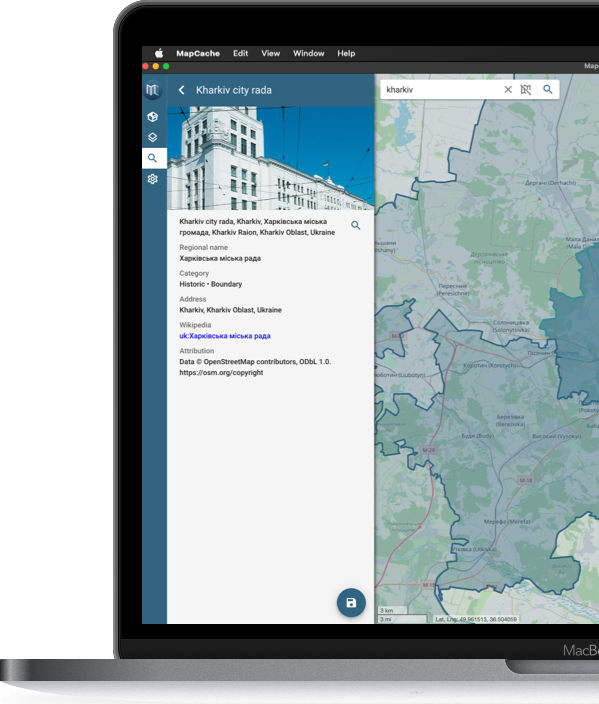
Find what's nearby with OpenStreetMap search. Set custom icons and style your polygons. Attach and save images.
Save your data into a GeoPackage and go offline in the field on Android and iOS
Fork it on Github

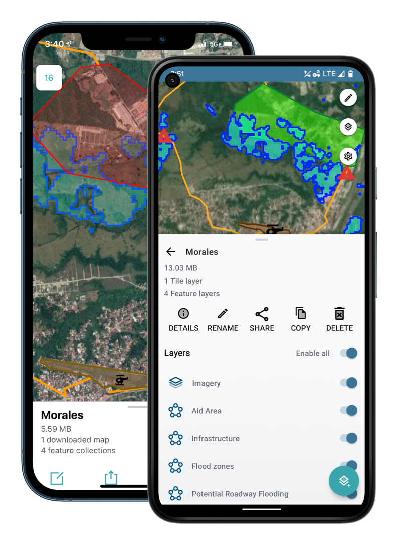

Download tiles from XYZ and WMS servers for use in disadvantaged areas. Create points and collect data in the field with custom forms and photo attachments.
Share your GeoPackages with other users via Android Beam or Airdrop. Use your data in other apps that support GeoPackage on your device.
Download from Google Play or the App Store on your device, or build it on your machine from source.


MapCache, and many other apps, are powered by the NGA's GeoPackage libraries.
The National Geospatial-Intelligence Agency (NGA), in collaboration with BIT Systems, makes available under the MIT License a collection of OGC GeoPackage spec libraries listed as GeoPackage implementations. The NGA GeoPackage Libraries include creation, visualization, and management SDKs including sample applications for Android and iOS.
An OGC Certified SDK that provides the ability to manage GeoPackage files providing read, write, import, export, share, and open support. Open GeoPackage files provide read and write access to features and tiles.


NGA defined GeoPackage extensions.


Command utility that executes SQL statements on a SQLite database, including GeoPackages.

Library for writing and reading Simple Feature Geometries to and from Well-Known Binary.


Library for writing and reading Simple Feature Geometries to and from Well-Known Text.


A non-standalone library providing core GeoPackage functionality to Java and Android libraries.


Command utility to perform coordinate transformations from a source projection to a target projection.

A Java implementation of the OGC Geographic information — Well-known text representation of coordinate reference systems specification (not GeoPackage specific).


A Java library providing Tagged Image File Format functionality (not GeoPackage specific).


A Java library for writing and reading OGC API - Features to and from JSON. Based upon the OGC API Specification (not GeoPackage specific).


Command utility to parse and pretty print OGC Coordinate Reference System Well-Known Text.

A Java library providing color representation with support for hex, RBG, arithmetic RBG, HSL, and integer colors.


A JavaScript library providing GeoPackage functionality and utilities to node and web applications.


Library for writing and reading Simple Feature Geometries to and from Well-Known Binary.


Library for writing and reading Simple Feature Geometries to and from Well-Known Text.


JavaScript library providing color representation with support for hex, RBG, arithmetic RBG, HSL, and integer colors.


An Android Map SDK providing GeoPackage map functionality (includes GeoPackage Android).


An iOS SDK providing GeoPackage functionality and utilities to iOS apps.


Official Reference Implementation

Library for writing and reading Simple Feature Geometries to and from Well-Known Binary.


Library for writing and reading Simple Feature Geometries to and from Well-Known Text.


Library for performing projection conversions between Simple Feature Geometries.


An iOS implementation of the OGC Geographic information — Well-known text representation of coordinate reference systems specification (not GeoPackage specific).


An iOS library for writing and reading OGC API - Features to and from JSON. Based upon the OGC API Specification (not GeoPackage specific).


An iOS library providing color representation with support for hex, RBG, arithmetic RBG, HSL, and integer colors.


Code examples from the talk at FOSS4G North America 2018 - St. Louis, MO.


Code examples from the lightening talk in September 2022.
GeoPackage file examples.
 Windows
 Linux
Linux


